
14 Best Places to Visit in Canada
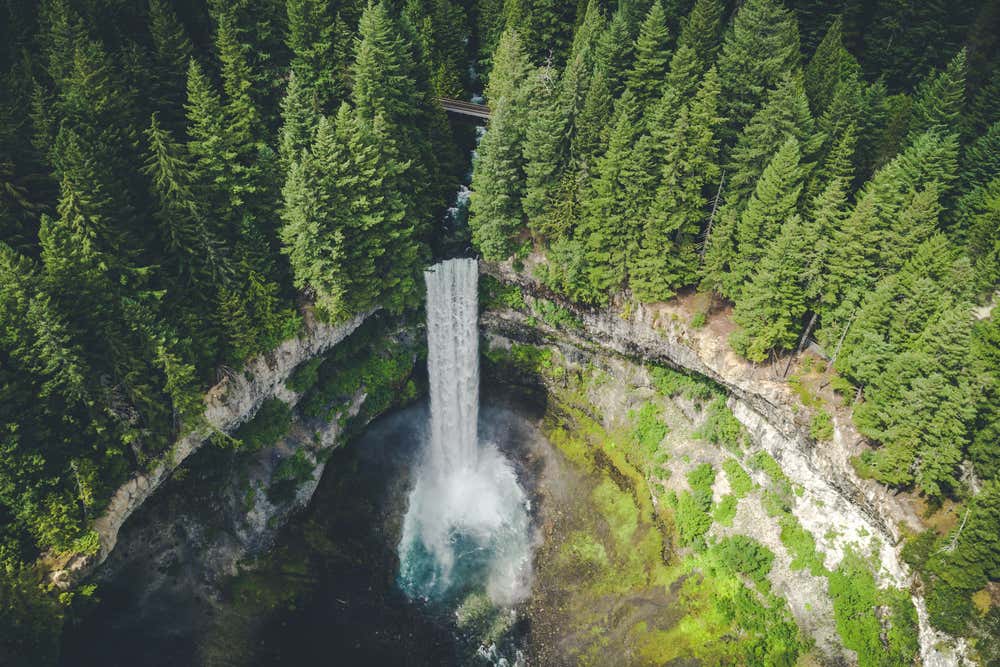

Canada is the second largest country in the world, and about four in five Canadians live within 100 miles (160 kilometers) of the US border. Almost everything above that line is forest, tundra, ice and water. That gap between where people live and how much space there is explains why you can stand on a lakeshore in July and hear nothing at all.
So what are the best places to visit in Canada? They are spread across six time zones, which means nobody sees them all in one trip. The Rocky Mountain lakes, Niagara Falls, the walled Old Quebec, the record tides of the Bay of Fundy and the northern lights over the Yukon each belong to a different vacation.
Here are fourteen worth building a trip around, with what makes each one different and what you need to know before you go.
Where to Visit in Canada?
1. Banff National Park, Alberta
Banff was Canada’s first national park, protected since 1885, and UNESCO added it in 1984 as part of the Canadian Rocky Mountain Parks. That makes it older than most of the towns around it.
What sets the scenery apart here is the color of the water. Glaciers grind rock into a fine powder called rock flour, which washes into the lakes and scatters light into that near impossible turquoise. You will see it in almost every lake in the park, and it deepens through mid and late summer once the melt is underway.
Everyone needs a national park pass to enter, even passing through. The Banff National Park tour covers the main viewpoints, or take a guided hiking route in Banff if you would rather earn the views.
2. Lake Louise, Alberta
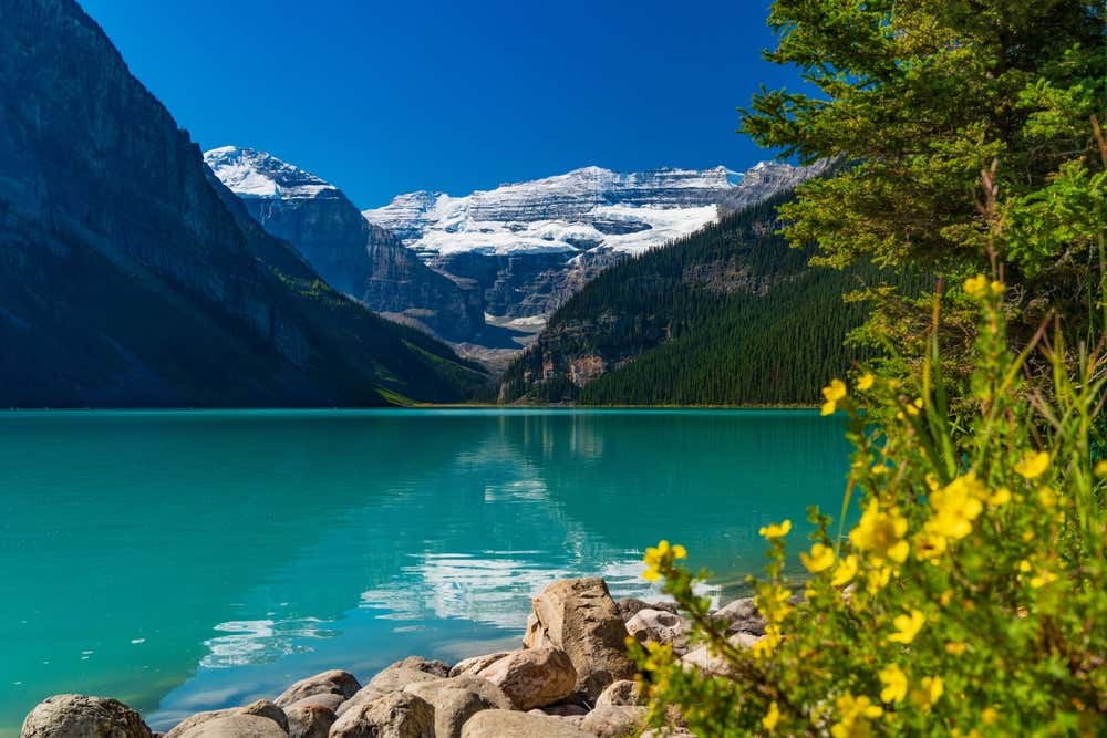
At about 5,680 feet (1,731 meters), Lake Louise fills a hanging valley with the Victoria Glacier at the far end. You are looking at the water and the ice that colors it in the same view. The Fairmont hotel on the shore has been photographed since 1890, and the lawn in front of it is open to everyone.
Most people stop at the shoreline, take the picture and leave. Walk 20 minutes along the north shore and the crowd thins out fast. Keep going and the trail climbs to the Lake Agnes Tea House, which has been serving hikers since 1905.
Parking lots fill before 7 AM in summer, which is the single biggest planning problem here. The Lake Louise trip from Banff removes that headache and adds scenic stops along the way.
3. Moraine Lake, Alberta
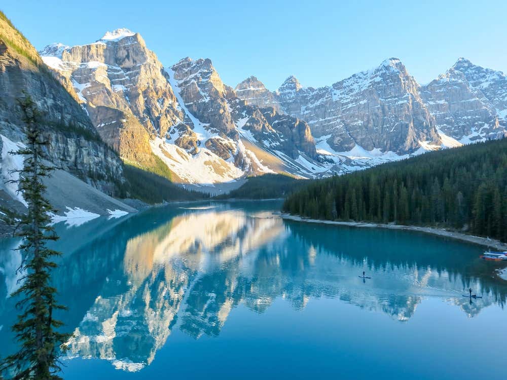
Ten sharp peaks rise behind water so intensely blue it looks edited. The Valley of the Ten Peaks appeared on the back of the Canadian twenty dollar bill for years, and standing on the rockpile you understand exactly why they picked it.
Here is the part to plan around. Moraine Lake Road is closed to personal vehicles. You cannot drive there. Access is by Parks Canada shuttle, Roam Transit, an authorized tour operator, or your own legs and a bike along 7.8 miles (12.5 kilometers) of paved road. The road itself is only open roughly June to mid October, since snow closes it the rest of the year.
Shuttle seats are released in advance and go quickly, so book the moment you know your dates. If you miss out or want something simpler, the Moraine Lake sunrise or sunset trip is one of the authorized ways in.
4. Icefields Parkway, Alberta
Highway 93 North runs 144 miles (232 kilometers) from Lake Louise to Jasper, and it is routinely called one of the great scenic drives in the world. You pass more than a hundred glaciers, waterfalls right at the roadside, and the milky blue of Peyto Lake, visible from a viewpoint a short walk from the parking lot.
The centerpiece is the Columbia Icefield, the largest mass of ice in the Rockies, which feeds the Athabasca Glacier as it comes down almost to the road. It is one of the few places you can stand on level ground and look straight at a glacier without hiking to it.
Give it a full day rather than three hours, because you will stop constantly. Gas stations are scarce along the route, so fill up before you leave if you are driving yourself. The Icefields Parkway tour from Banff runs about eleven hours and lets you watch the scenery instead of the road.
5. Jasper National Park, Alberta
Jasper is the largest park in the Canadian Rockies at roughly 4,200 square miles (11,000 square kilometers), and it is quieter than Banff for the simple reason that it is further from a major airport. It is also a Dark Sky Preserve, so on a clear night you can see the Milky Way from the middle of town.
You should know what happened here. A wildfire swept through the park and the townsite in July 2024 and damaged around a third of the buildings. Jasper has been rebuilding since, the town and park are open, and most trails have reopened.
Much of the best of it came through untouched. Maligne Lake, Athabasca Falls and the Columbia Icefield are open and show no sign of the fire. Check the Parks Canada interactive map before you travel for any closures still in effect, and browse the activities in Jasper for what is running.
6. Niagara Falls, Ontario
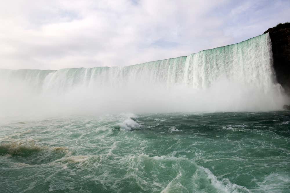
Horseshoe Falls is about 2,200 feet (670 meters) wide and drops roughly 167 feet (51 meters), but the figure that stays with you standing in front of it is the volume. Enough water goes over the edge every second to fill an Olympic pool several times over.
The Canadian side has the better view, and it is not close. From Ontario you look straight into the curve of the Horseshoe, while the American side only gives you the edge of it. That accident of geography is the reason the Canadian bank is built up the way it is, and it is worth crossing for even if you are coming from Buffalo for the day.
Go early or stay late if you can, since summer midday is by far the most crowded. You can run the rapids downstream on the Niagara River jet boat ride, or come in from the city on the Niagara Falls day trip from Toronto. The activities at Niagara Falls section has the rest.
7. Thousand Islands, Ontario
The count is 1,864 islands, scattered through the St. Lawrence River right where it leaves Lake Ontario. The rule is that an island counts if it stays above water year round and supports at least one living tree. Some are big enough for a village. Others fit one house and nothing else.
The granite here belongs to a ridge connecting the Canadian Shield to the Adirondacks, which is why the shores are pink rock and pine rather than sand. Gilded Age families built summer castles on the larger islands, and several still stand.
You want to be on the water rather than beside it, so a boat trip out of Gananoque or Kingston is the way to do it. The river forms the international border here, so bring your passport if you plan to cross.
8. Old Quebec, Quebec
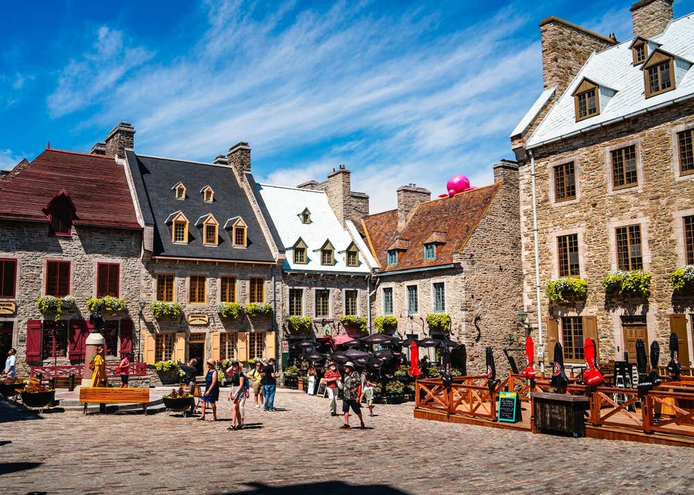
Founded in 1608, Quebec City keeps the only surviving fortified walls in the Americas north of Mexico, which is why UNESCO listed the old town in 1985. Walk the ramparts and you are on a defensive line people were still arguing about in the 19th century.
You will recognize the Château Frontenac above the river, often called one of the most photographed hotels in the world, and below it the Quartier Petit Champlain runs along some of the oldest shopping streets on the continent. In winter the whole thing disappears under snow and turns faintly unreal.
Ten minutes from downtown, Montmorency Falls drops 272 feet (83 meters), about a hundred feet higher than Niagara, though almost nobody outside Quebec has heard of it. Start with the Quebec free walking tour to get the layout and the history in one go, or the walking tour of Old Quebec for more depth.
9. Bay of Fundy, New Brunswick
The highest tides on the planet happen here, rising and falling up to 52 feet (16 meters) twice a day. The shape and length of the bay happen to match the natural rhythm of the water sloshing inside it, so each tide reinforces the last, and the result is a coastline that remakes itself every six hours.
At Hopewell Rocks you can walk the sea floor among sandstone formations at low tide, then come back later and kayak over the same ground. All it takes is getting the timing right.
Check a tide table before you go, because arriving at the wrong hour means seeing half the show. Saint John works as a base on the New Brunswick side, and across the water in Nova Scotia the guided tours and boat trips in Halifax cover the port city.
10. Prince Edward Island
Canada’s smallest province is a strip of red sandstone in the Gulf of St. Lawrence, and the iron in that stone is why you get rust colored cliffs and beaches against green fields and blue water. No other coastline in the country looks like it.
Cavendish is where Lucy Maud Montgomery set Anne of Green Gables, and the farm that inspired the novel is preserved as a national historic site. The book has been drawing visitors here from Japan in particular for decades.
The Confederation Bridge runs 8 miles (12.9 kilometers) from New Brunswick and takes about 12 minutes to cross. You will find things to do in Charlottetown and across the rest of Prince Edward Island.
11. Vancouver Island, British Columbia
At roughly 285 miles (460 kilometers) long, Vancouver Island is big enough to hold rainforest, mountains, farmland and a provincial capital without any of them crowding the others. The east coast is sheltered and settled, the west coast takes the full weight of the Pacific, and the difference between them is startling.
Victoria sits at the southern tip, with its harbor and the Butchart Gardens just outside, built from 1904 onward in a worked out limestone quarry. It is one of the few places where an industrial scar became the main attraction. The Victoria day trip from Vancouver is the easiest way over.
The waters around the island hold orcas, humpbacks and gray whales through the summer. Go looking on the whale watching trip from Vancouver, or head for Telegraph Cove at the northern end, one of the best places in the country for it.
12. Tofino, British Columbia
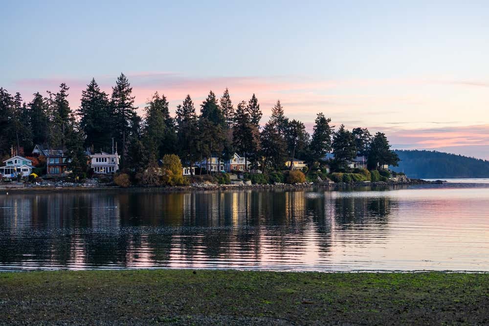
On the exposed west coast of Vancouver Island, Tofino sits between old growth rainforest and open ocean. Long Beach runs for miles inside Pacific Rim National Park Reserve, and neighboring Clayoquot Sound was named a UNESCO Biosphere Reserve in 2000.
Most beach towns sell you the summer. Tofino sells you the winter, and it works. From November to February, Pacific storms throw swell against the headlands, and people book rooms specifically to sit behind glass and watch. Storm watching is a real season here, with its own rates.
Come in summer instead and you get cold water surfing, hot springs reachable only by boat, and bears flipping rocks on the tide flats. The wider activities in British Columbia section covers the region.
13. Whistler, British Columbia
Whistler hosted the alpine events at the 2010 Winter Olympics and remains one of the largest ski resorts in North America, with two mountains you can cross on the PEAK 2 PEAK gondola. That crossing runs 2.7 miles (4.4 kilometers) and holds the record for the longest unsupported span in the world.
Summer is arguably the better season, combining alpine hiking, lake swimming and some of the best mountain biking anywhere. Have a look at the activities in Whistler before you decide when to go.
14. Northern Lights in the Yukon and Northwest Territories
Yellowknife sits almost directly under the auroral oval, the ring where solar particles meet the atmosphere, and it has flat terrain and dry, clear winter air working in its favor. It is one of the best places on earth to see the northern lights, which is why people fly in from Asia specifically for this.
The season runs roughly from late August to April. You need darkness, so the endless light of a northern summer rules out June and July completely. Give yourself at least three nights, because one cloudy sky can take away your only chance.
Both Yellowknife and Whitehorse in the Yukon run aurora tours right through the season. If you cannot get that far north, the stargazing and northern lights night in Banff is a long shot for the aurora and a sure thing for the stars.
Best Time to Visit Canada
Seasons shift from year to year and mountain roads can open late after a heavy winter, so check current conditions before you lock in dates. As a general guide:
How Long Do You Need in Canada?
Think in regions, not in countries. Ten days covers the Rockies properly, giving you Banff, Lake Louise, Moraine Lake, the Icefields Parkway and Jasper without rushing any of them. A different ten days covers Vancouver, Vancouver Island and Tofino.
The eastern trip is its own thing again. A week gives you Montreal, Old Quebec and a run down the St. Lawrence, and you would add another week for the Maritimes and Prince Edward Island. The aurora is a short winter trip of its own, three or four nights.
If you would rather have it organized for you, the multi-day tours departing from Toronto package several regions into one itinerary.
Canada Travel Tips
Park passes: every national park charges admission, and if you are visiting more than a couple, the Parks Canada Discovery Pass pays for itself quickly. Buy it at the gate or online before you travel.
Entry requirements: US citizens do not need a visa or an eTA to enter Canada, just a valid US passport. Travelers of other nationalities usually need one or the other depending on their passport. Requirements change, so confirm yours with the Canadian embassy or consulate rather than relying on a travel article.
Distances: this is the thing people underestimate most. Vancouver to Toronto is about 2,700 miles (4,350 kilometers), so flying between regions is normal here rather than extravagant. Once you are inside a region, a car opens up everything a bus cannot reach.
Wherever you land, booking ahead through Civitatis’s full catalog means spending your first morning on a trail instead of in a ticket line.


Most read of #North America
Top 10: The Best Cities to Visit in Mexico (2026)
9 October 2026The 8 Best Day Trips from Philadelphia in 2026
8 October 2026Iconic Food in Chicago: 17 Dishes You Have to Try
30 September 2026Best Time to Visit Hawaii: A Season-by-Season Guide
29 September 202615 Best Things to Do in Mérida, Mexico
25 September 2026Cancun Beaches: The 9 Best Spots for Sun and Sand
25 September 2026Most read #North America
Top 10: The Best Cities to Visit in Mexico (2026)
9 October 2026The 8 Best Day Trips from Philadelphia in 2026
8 October 2026Iconic Food in Chicago: 17 Dishes You Have to Try
30 September 2026Best Time to Visit Hawaii: A Season-by-Season Guide
29 September 202615 Best Things to Do in Mérida, Mexico
25 September 2026
11 Pueblos Mágicos Near Mexico City Worth the Trip
23 September 2026Oaxaca Beaches: 10 Best Spots on the Pacific Coast
22 September 2026Best Time to Visit Tulum: Weather, Crowds and Sargassum
12 September 2026Cancún to Isla Mujeres: Ferry, Catamaran and Costs
11 September 2026
What to See in Jalisco in 2026: Lake Chapala, Tequila & More
31 August 202614 Best Places to Visit in Canada
28 August 2026What to See in San Luis Potosí, Mexico: 11 Highlights
14 August 2026The 10 Best Things to Do in Puerto Vallarta, Mexico
14 August 2026
15 Famous Landmarks in Mexico, from Maya Ruins to Canyons
12 August 2026The 14 Most Beautiful Places to Visit in Canada
11 August 202616 Best Things to Do in Querétaro, Mexico
10 August 2026Top 11: The Best Day Trips from Mexico City (2026)
5 August 2026